FISH WEIRS AND PONDS IN THE BOLIVIAN AMAZON
Figures:
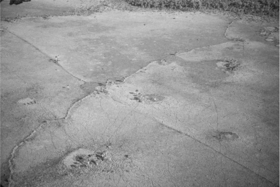
Figure 1: “Oblique photograph of a fish weir and artificial ponds between forest islands in the savannahs of Baures. Fish weirs are the zigzag structures, lower left to upper right; artificial ponds are the circular features surrounded by palms (approximately 20 m in diameter). The diagonal feature (upper left to lower right) is a contemporary path” (Erickson 2000: 192).
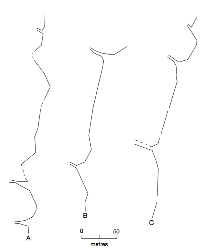
Figure 2: “Plans of fish weirs (zigzag structures). Small parallel openings in the weirs are present every 50-200 m” (Erickson 2000: 193).
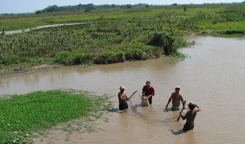
Figure 3: Photograph: Clark L. Erickson, from Net Fishing in the Bolivian Amazon presentation
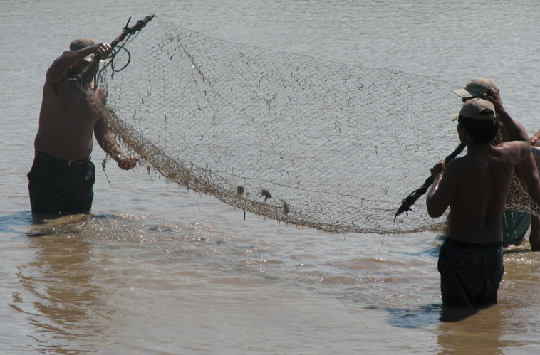
Figure 4: Photograph: Clark L. Erickson, from Net Fishing in the Bolivian Amazon presentation
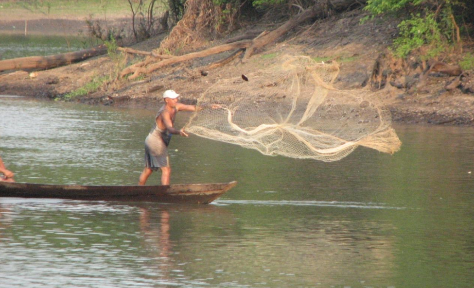
Figure 5: Photograph: Clark L. Erickson, from Net Fishing in the Bolivian Amazon presentation
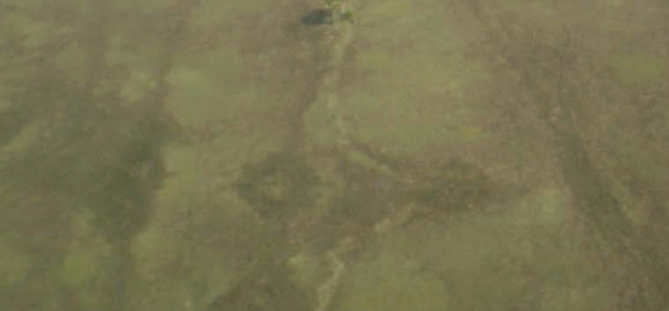
Figure 6: Photograph: fish weir, Clark L. Erickson, from Baures Landscapes for 3d Modeling in Unity presentation (2016).
Figure 7: Photograph: weir opening from ground, Clark L. Erickson, shared on Penn Box.
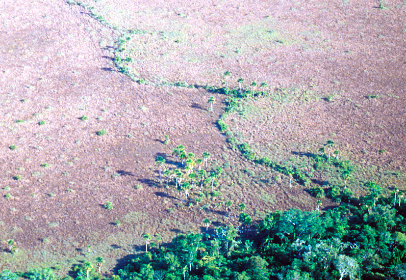
Figure 8: Photograph: fish weirs, Clark L. Erickson, shared on Penn Box.
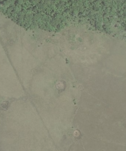
Figure 9: Screenshot of the original area I intended to model (Microsoft 2016). I failed to take scale into account
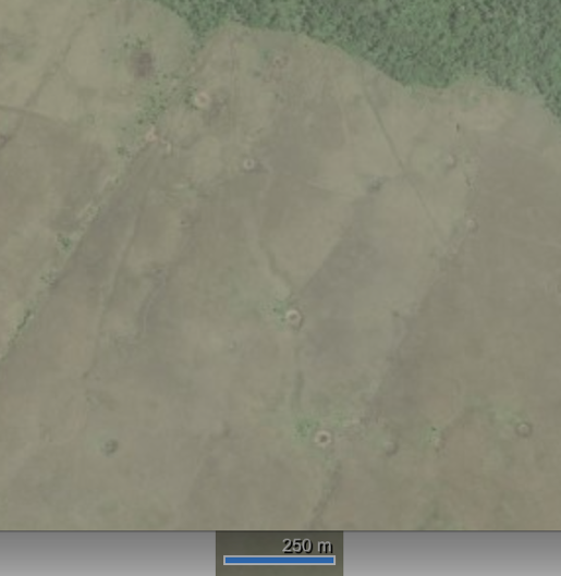
Figure 10: Screenshot of second area intended for modeling (Microsoft 2016).
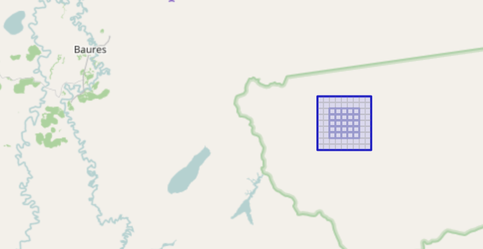
Figure 11: Attempt at capturing real-world height map, using terrain.party (OpenStreetMaps 2016). The blue, square grid has a side length of 8km
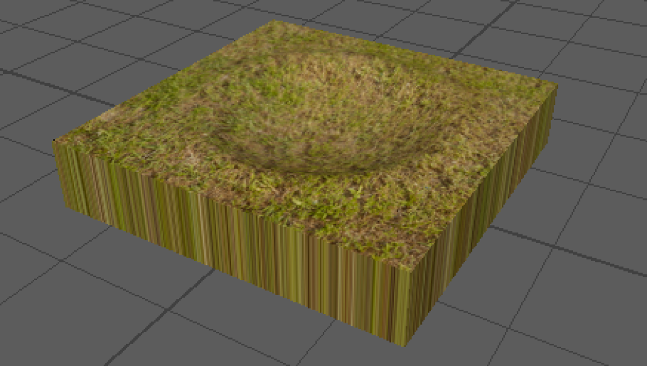
Figure 12: My first Maya fish pond model, which fails to take scale into account
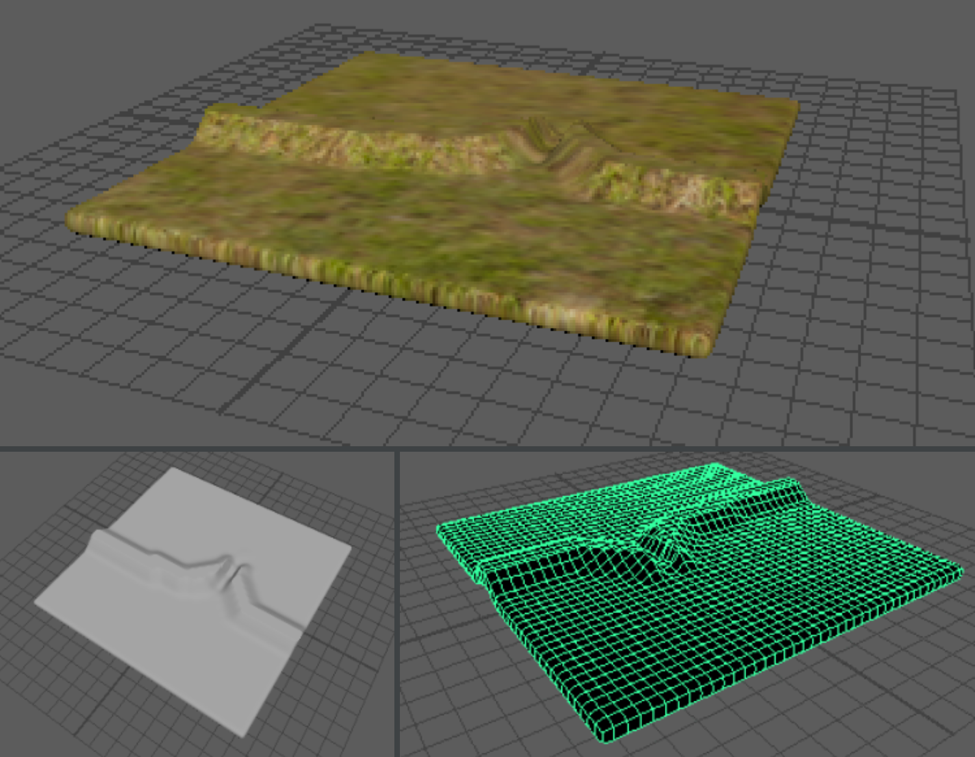
Figure 13: A few different angles and views of my first Maya fish weir, which fails to take scale into account
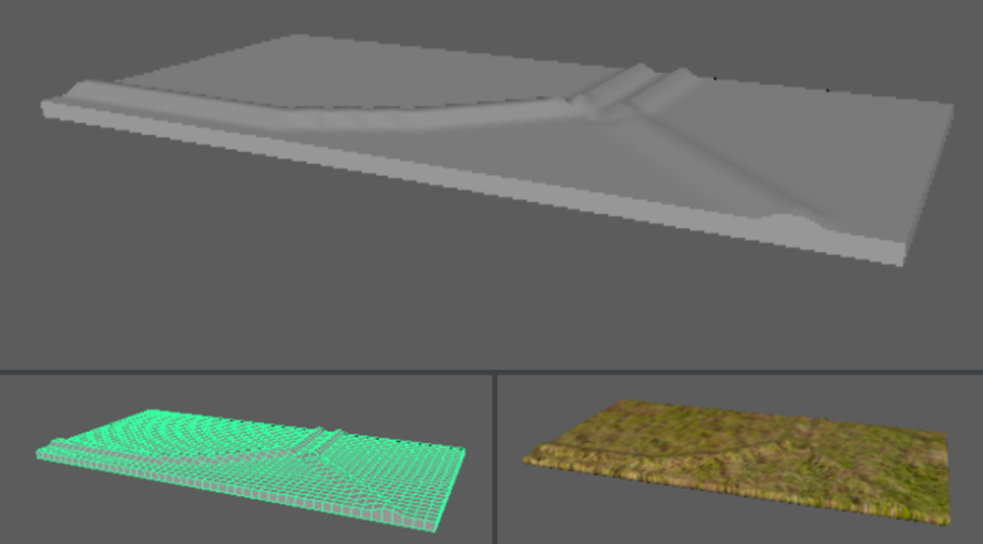
Figure 14: Accurately scaled fish weir. Each square in the gridded model (bottom left) has a side length of 1 m
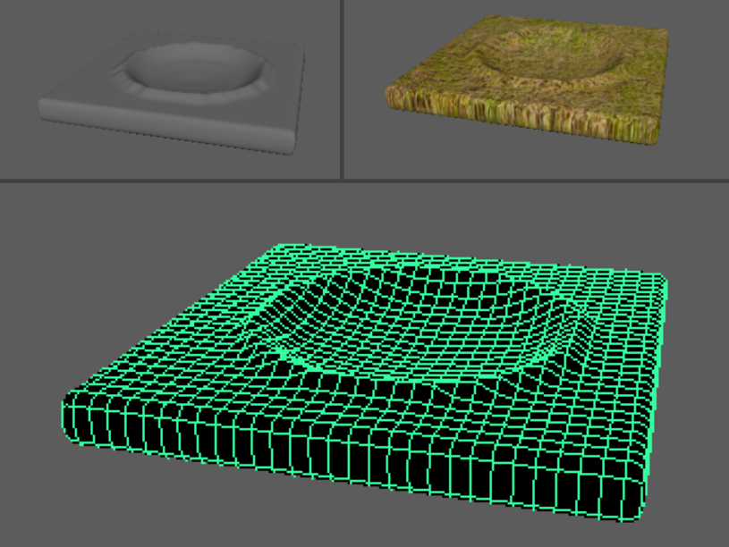
Figure 15: Accurately scaled fish pond. Each square in the gridded model (bottom) has a side length of 1 m
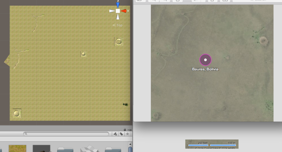
Figure 16: Unfinished assembled scene, next to screenshot of location on Bing Maps (Microsoft 2016).
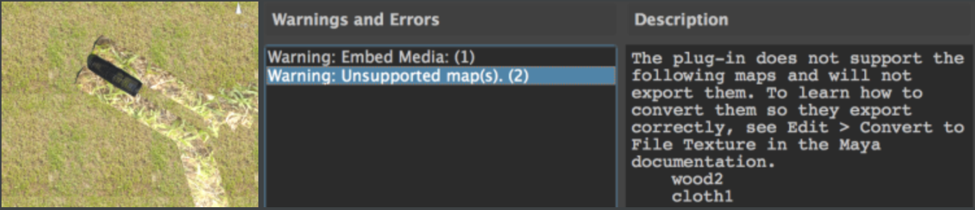
Figure 17: James Prell’s weir trap, imported, with texture importation failure notification.
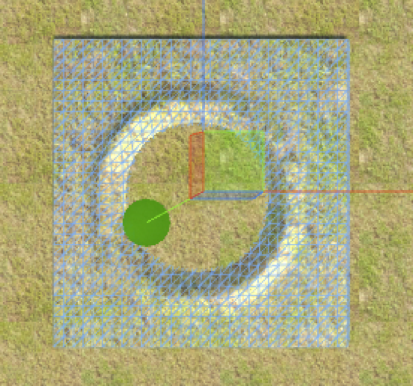
Figure 18: Pond model superimposed over terrain object, on which I could not lower the terrain to show the depth of the pond. Each square on the pond object grid has a side length of 1 m.
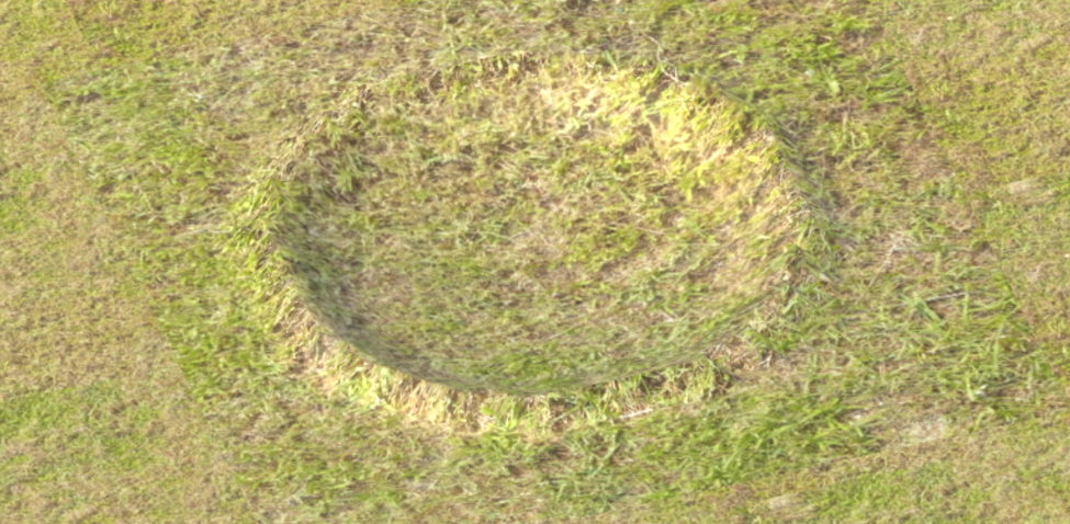
Figure 19: Fish pond with 20 m diameter in Unity scene.
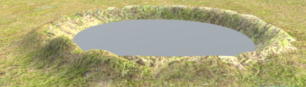
Figure 20: Fish pond with 20 m diameter, realistic berms, and un-textured water in Unity scene.
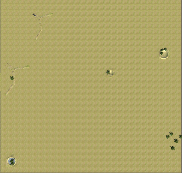
Figure 21: Unfinished 450 km2 Unity scene from above with palms included.
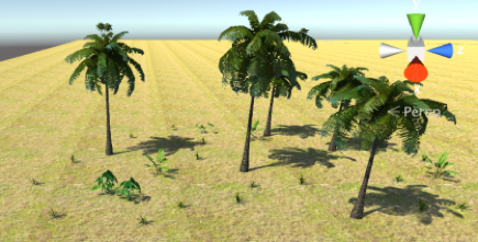
Figure 22: Vegetation in Unity scene.
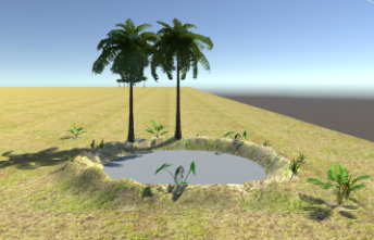
Figure 23: Vegetation in another part of the Unity scene.
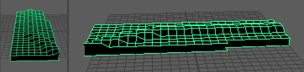
Figure 24: Two views of the weir connector model. 1 square has a side length of 1 m.
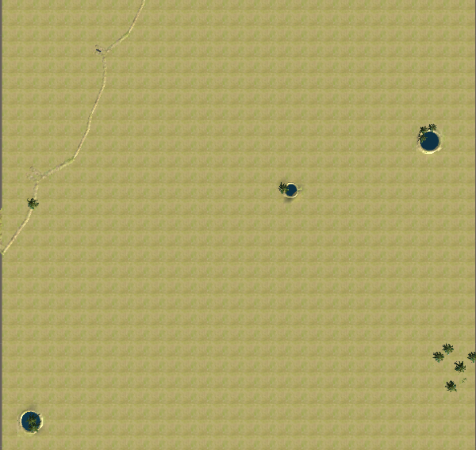
Figure 25: Complete 450 km2 Unity scene during the dry season. The weir trap (black figure in the upper left) would not actually be left in this position during the dry season.
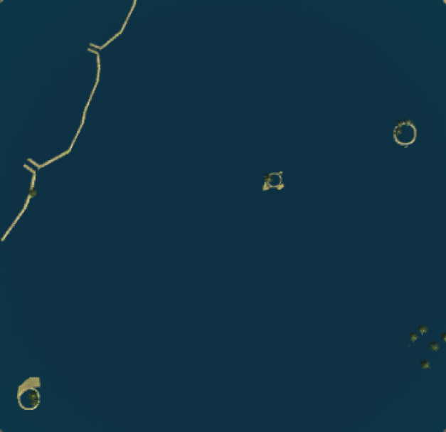
Figure 26: Complete 450 km2 Unity scene, flooded. The misshapen ponds reflect a texture rendering error in the game engine.
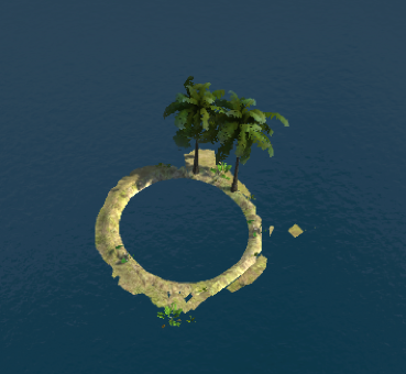
Figure 27: Close up screenshot of a flooded fish pond, highlighting the different texturing by the game engine. This is the pond from the lower left hand corner of Figure 26.